Great Salt Lake Integrated Model
The Great Salt Lake’s natural resources, and economic and ecological benefits that are derived from them, are directly related to water levels and salinity in the lake that, in turn, are directly related to inflows to and withdrawals from the lake. A tool was needed to integrate available water resources information and data to enable an understanding of how future changes in the watershed may influence the resources of GSL. GoldSim dynamic simulation software was used to build the Great Salt Lake Integrated Model (GSLIM).
The GSLIM project provides state agencies and GSL stakeholders with a tool that can accomplish the following:
- Describe how changes in GSL and its watershed could impact the lake’s water levels and salinity
- Be used to evaluate potential impacts to and changes in the lake’s resources
- Serve as a foundation for addressing future management challenges
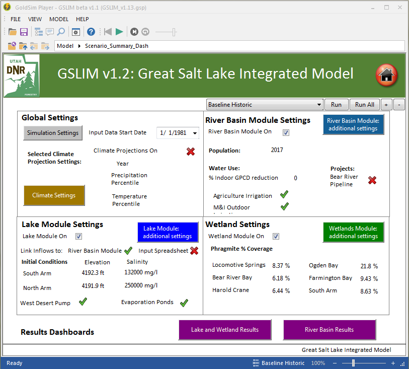
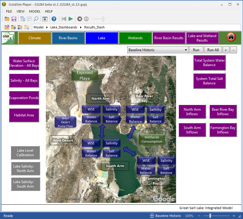
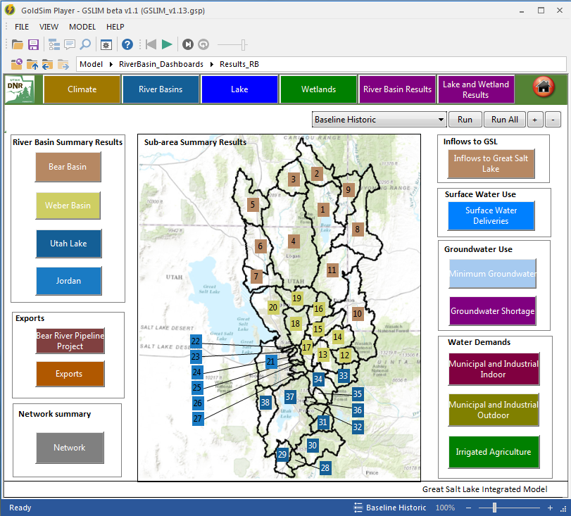
The approach for developing the GSLIM was to conceptualize the model in terms of integrated modules within one core GSLIM. Each river basin that drains to the lake—Bear, Weber, and Jordan Rivers—are represented by a separate River Basin module. Inflow from each river basin has been filtered through a second module representing the wetland complexes that exist at the interface between each river and GSL. The Wetland module incorporates the unique characteristics for the wetlands at the mouth of each river. The third module represents the lake itself and characterizes each of the four main bays: Gilbert (South Arm), Farmington, Bear River, and Gunnison (North Arm) Bays. Dividing the model into these different modules facilitated integrating existing data and models, as well as completing future updates and use by stakeholders within each river basin.
Definition and integration of business, social, and technical factors created a model that not only represented a complete water balance for the watershed but sought to improve how that information could be used and developed in the future. The model incorporates climate factors, estimates of runoff and system storage, and detailed use of water (natural, agriculture, and M&I water use [indoor, outdoor and CII]) for 38 river sub-basins across Utah, Wyoming and Idaho. The model was structured to facilitate a robust scenario planning process that allows for users to better understand how changes in any of the watershed variables, e.g., climate, land use, population, M&I use, etc., could affect water demand, supply, river flows to Great Salt Lake, and the resulting lake levels and salinity.
The model supports the business functions of resource and regulatory agencies; continue to evolve with input from stakeholders, researchers, and model users; and serve as a common basis for future management decisions.
Contact:
Jeff DenBleyker, PE
Email: [email protected]
Phone: 385-474-8515